Utah’s National Parks & Monuments
History, Geology, and the Best Places to Visit
[March 6, 2023 | Montrose Mirror | By Kathryn R. Burke]
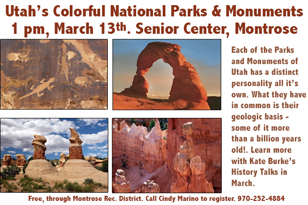
Each of the Parks and Monuments of Utah (and the surrounding 4-Corners area) has a distinct personality all its own. What they have in common is their geologic basis—some of it more than a billion years old!
Geology. The area lies atop an underground salt bed, responsible for the arches, spires, balanced rocks, fins, and monoliths. Thousands of feet thick in places, this salt bed was deposited over the Colorado Plateau some 300 million years ago, when a sea flowed into the region and eventually evaporated. Over millions of years, the salt bed was covered with residue from floods, winds, and oceans that came in intervals. Much of the debris was compressed into rock. At one time this overlying earth may have been 1 mile thick.
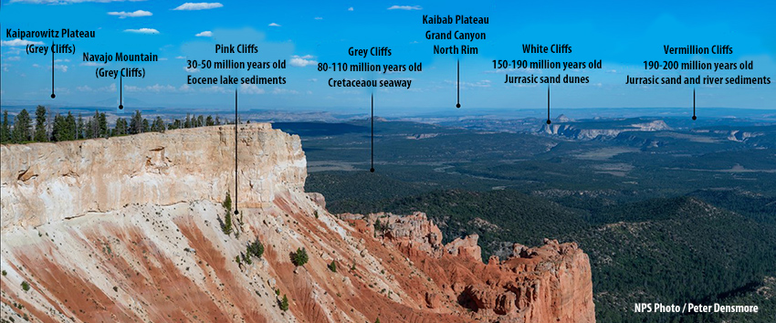
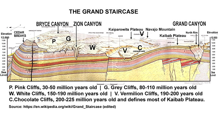
The Grand Staircase exhibits five ‘steps’ of rocks or ‘cliffs’—Chocolate, Vermillion, White, Gray, Pink—range in age from 30 million to 225 million years old.
The sedimentary rock layers that lie on the Colorado Plateau, encompass parts of Utah, Colorado (the largest), Arizona, and New Mexico—an area with 5 national parks, 8 national monuments, 8 Scenic Byways, 2 National Recreation Areas, 1 National Historic site, and 2 Tribal Parks.
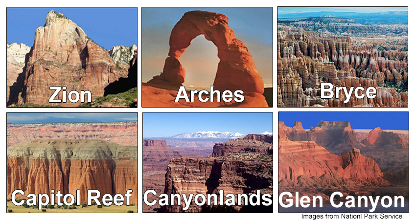
The Big Five—Zion, Brice Canyon, Capitol Reef, Arches, and Canyonlands National Parks—are the most visited National Parks, as is Glen Canyon in Arizona.
Zion National Park. It was the first National Park, established in 1909 as Mukuntuweap National Monument, then renamed Zion National Park 10 years later.
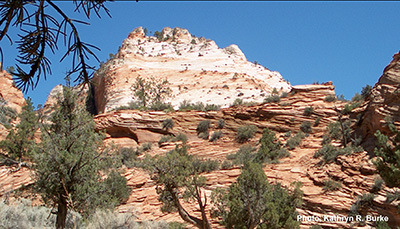
When I think of Zion, I think of dessert. Massive sandstone cliffs of cream, pink, and red remind me of Peach Melba or strawberries with whipped cream. Dark pockets of vegetation beneath a rocky red hoodoo, look like a chocolate sundae with cherry on top. Zion is a visual treat, and it is one of my favorite parks. The word ‘delectable’ comes to mind.
Arches National Park. Landscape Arch in Arches National Park is the longest natural arch in the world—it spans 290 feet and is only 7 feet thick! The park also has the greatest density of arches (over 2000), and includes some double arches like you see here.
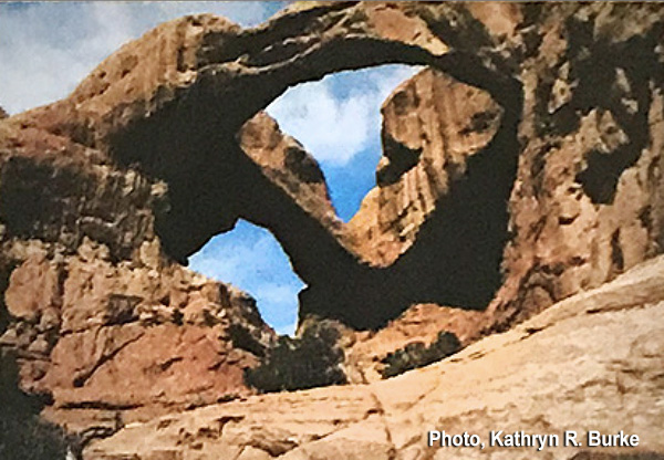
Arches Scenic Drive is easy to travel by car. Some of the largest arches, like this spectacular Double Arch, are in the Windows Section. A self-guiding booklet is available at the Visitor Center. which should be your first stop on your tour.
Bryce Canyon and Hoodoos. Bryce is not a single canyon, but a series of natural amphitheaters or bowls, carved into the edge of a high plateau. Bryce is also distinctive due to its large collection of geological structures called hoodoos. Also called a tent rock, fairy chimney, or earth pyramid, they are occur within sedimentary and volcanic rock formations. Hoodoos range in size from the height of an average human to heights exceeding a 10-story building. Mineral deposits in the different layers cause them to have different colors throughout their height.
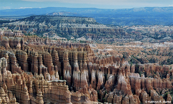
The most famous natural amphitheater is the Bryce Amphitheater, which is filled with irregularly eroded spires of rocks (or hoodoos).
The Grand Staircase National Monument is the largest national monument in the U.S. encompassing 1,880,461 acres. It is among the most remote land in the U.S. and was the last to be mapped in the contiguous United States. There are three main regions: the Grand Staircase, the Kaiparowits Plateau, and the Canyons of the Escalante (Escalante River). What makes the Grand Staircase worldly unique is that it preserves more Earth history than any other place on Earth. Ranging in elevation from sea level t 12,000 feet, the rock formations, ranging from 30-225 million years old, comprise one of the most studied geologic columns in the world.
The Trail of the Ancients, a National Scenic Byway, is approximately 480 miles long and traverses both Colorado and Utah. In Utah, it goes from Hovenweep, through Blanding to Natural Bridges, and on to Monument Valley, ending at Mexican Hat in the Four Corners. If you have not visited Utah, or experienced any of its wonders, this is a good place to start. You’ll explore geologic, archeological, and cultural history while encountering some of the most spectacular country in the United States. Take a camera and make sure your phone is fully charged. You’re going to take a lot of pictures.
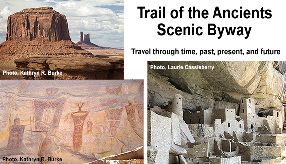
Pictured: Monument Valley Tribal Park, Pictographs in Sego Canyon, Cliff Palace at Mesa Verde.
Geologic and cultural history. Utah’s 27 state and national scenic byways are a geologic history book traversing 2,200 miles of magnificent red rock canyons and towering rock formations. From dinosaur footprints, to ancient heritage sites, to ghost towns, to vibrant modern cities, you’ll experience a landscape shaped by time.
The land has been inhabited more than 14,000 years. [Related story] The earliest arrivals likely came into North America from Asia via the Bering land bridge, then spread south to what we now call America’s southwest. As early as 7,000 BCE, indigenous peoples, mostly hunter-gatherers following game, began populating the region. Ancestral Pueblos—the Anasazi, Mogollon, and Hohokam—began farming here as early as 2000 BCE. Five cultures have inhabited this area since Pre-Columbian times: e Pre-Columbian times: Ancestral Puebloans (Anasazi) around 1300 BC; Freemont. AD-1301; Spanish, 1500s; Uto-Aztecan and Navajo (1700s); Mormon settlers. They have all left traces of their time here. At Dinosaur National Monument, The Uinta Fremont Indian petroglyphs are over 1000 years old. Newspaper Rock contains petroglyphs and pictographs from four different indigenous peoples.
Dinosaurs. If you’re fascinated by dinosaurs, at Jurassic National Monument, a complete, 28-foot long Allosaurus skeleton has been excavated. Dinosaur National Monument, which spans the border of Utah and Colorado, contains over 800 paleontological sites and has a wide range of fossils. If you haven’t visited it, do. You will be enthralled. If you’re like me, the first time you traverse the walkway past the enormous creatures, still partially embedded in rock, it will be a jaw-dropping experience. These things were huge!
There’s lots more to share about the history and geology of this magnificent part of the U.S. right here in our own backyard, a place which preserves more of Earth’s history than anywhere else in the world! Learn a little more when Kate Burke presents Utah’s Parks and Monuments as part of her popular Western History series, March 13th, 1 pm at the Montrose Senior Center. During her presentation, Kate will distribute maps and informative material provided by the Utah Departments of Transportation and Tourism.
